The Cumbria Way is a long-distance footpath that starts in Ulverston in South Cumbria and ends up in the county’s capital city, Carlisle, in the north. It’s a tough, 70-mile long walk with a lot of difficult terrain and mountains to scale. However, it’s also a truly beautiful and awe-inspiring route. The path runs alongside a number of lakes and takes in some of the best views of the Lake District and other areas of Cumbria.
If you need to be convinced of the treats in store, take a look at my photo tour of some of the best view on the Cumbria Way.
Ulverston
Ulverston, close to Morecambe Bay, is the starting point of the long-distance path. This south Cumbrian town is known for its packed events calendar throughout they year and its proximity to the coast. Before you set off, I would highly recommend taking some time to look over spectacular Morecambe Bay.
Coniston Water

The first big Lake District site you come to is Coniston Water in the South Lakes, and you walk right along the edge of the western shore for a good distance.
Coniston is well know as the site of Donald Campbell’s tragic speed record attempt, as well as several of his successful ones. It also served as inspiration for Swallows & Amazons by Arthur Ransome. You can still see many people enjoying boating on the lake to this day, and it’s a truly picturesque site.
Tarn Hows
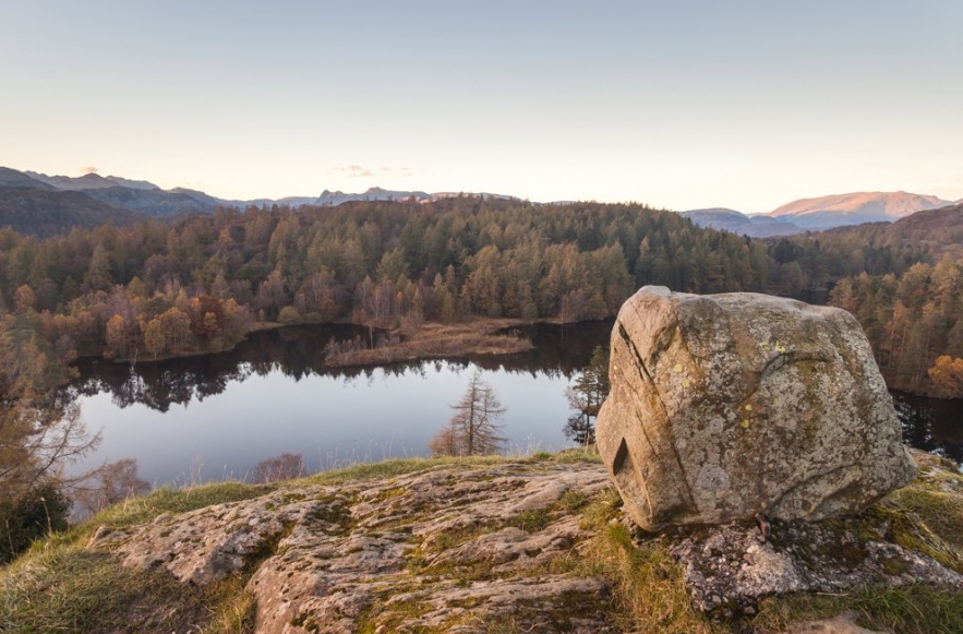
Once you’ve passed the northern tip of Coniston, it’s onwards to Tarn Hows, the Lake District’s smallest lake. This is also a man-made lake, though you’d never think so by looking at it. Tarn Hows is surrounded by trees and beautiful scenery, and was once owned by Beatrix Potter before she gifted it to the National Trust.
If you enjoy a walk, but are looking for something considerably easier than the Cumbria Way, Tarn Hows offers lovely flat routes that are suitable for wheelchairs and prams.
Skelwith
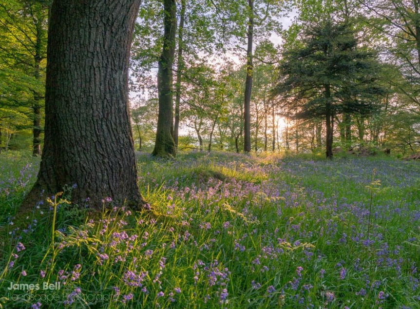
Much of the area between Tarn Hows and Coniston is Skelwith. Here you’ll find roaring waterfalls like Skelwith Falls and atmospheric woodland. On warm days, you’ll be glad of the cool shade as the path passes under the trees.
The River Brathay
From Skelwith Force you’ll wander downstream along the River Brathay for a short while, taking in the criss-crossing bridges over a series of smaller but lovely waterfalls. The woodland then opens out and you continue to follow the gentle meandering of the river.
Elterwater
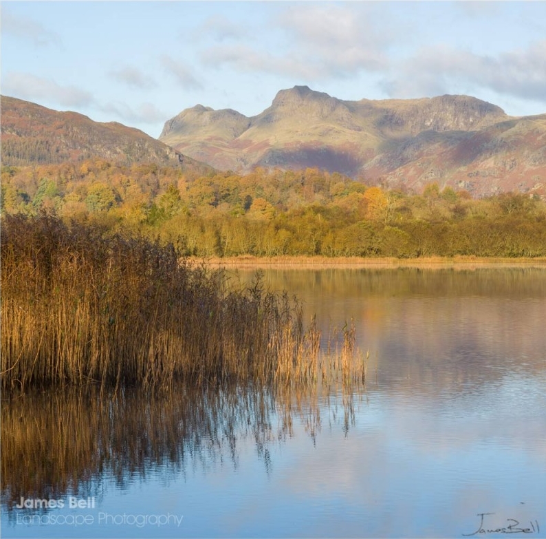
Eventually you reach Elterwater, an oddly-shaped lake that sits in the foreground ahead of the magnificent Langdale Pikes. As the river flows into the lake, the peaks come into view in the distance, creating a truly awe-inspiring sight. The route runs right by Elterwater village – a good pit stop before reaching Great Langdale.
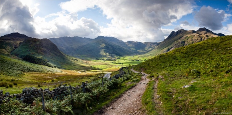
The Langdales
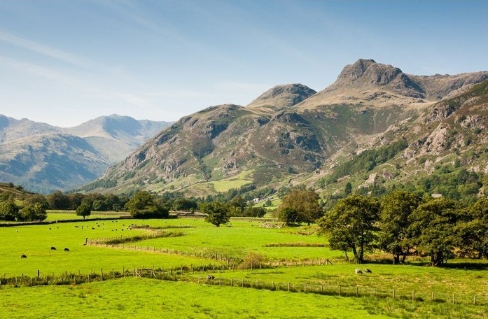
The Langdale Pikes create one of the Lake District’s most impressive and dramatic spectacles. Unfortunately (or fortunately, depending on your opinion), the Cumbria Way doesn’t go up them, but you can certainly admire the view from the valley of Great Langdale. The route skirts the edges of the fells around here, sticking to the valley bottom and the rivers . It’s not until Black Crags that you have any serious climbing to do.
Borrowdale

After a steep ascent from Great Langdale, and another steep descent, you’ll find yourself in another spectacular valley: this time Borrowdale. You’ve crossed over now from the South Lakes to the North Lakes and are a little short of halfway along the route.
Borrowdale has some of the Lake District’s most impressive mountain scenery, as well as tumbling rivers and lush woodland. You’ll stick to the valley bottom throughout, mostly following along Stonethwaite Beck and the River Derwent.
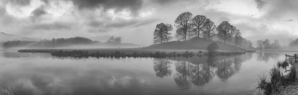
Derwentwater
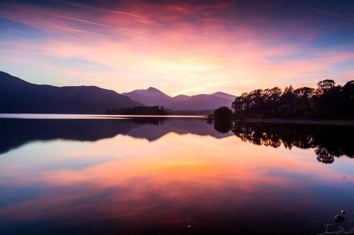
The River Derwent flows into Derwentwater, and the Cumbria Way continues alongside the west shore. This lake is often considered the jewel in the Lake District’s crown thanks to its epic surrounding scenery.
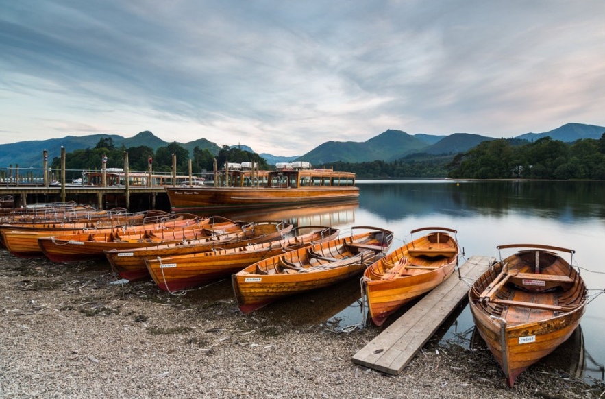
If you fancy cheating a little, this is a good spot to rest your legs and catch a Keswick Launch from one of the jetties. You can hop on a boat at High Brandlehow, right off your route, and join again at Nichol End Marina at the north of the lake, or even continue all the way round to Keswick on the east shore.
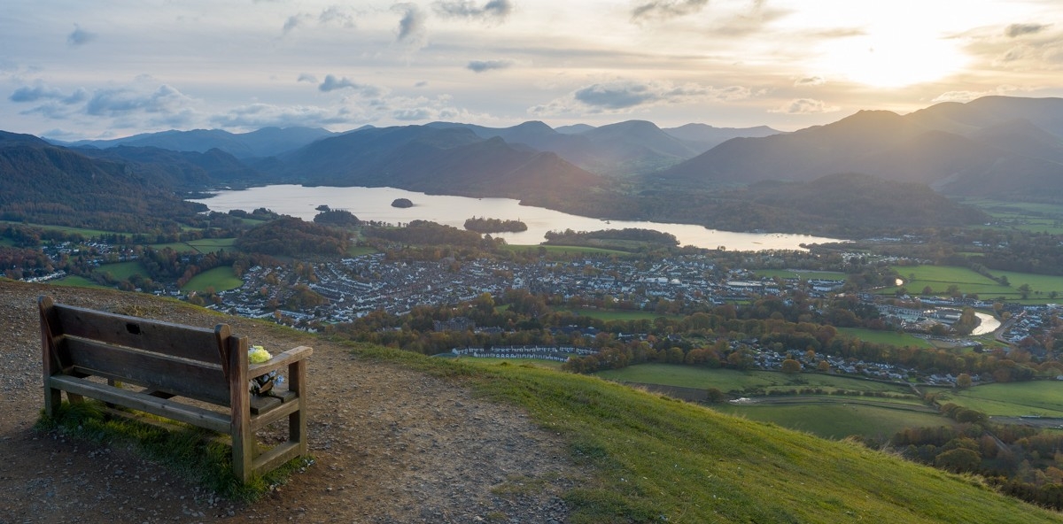
Keswick
Now you really are at your half way point and Keswick is the perfect place to stop for a rest, a meal, or even a break for a few days. It’s a bustling market town with plenty of events and activities going on, as well as lots of accommodation and facilities.
Skiddaw & Latrigg
After you’ve left Keswick, you’ll climb part way up the small mountain of Latrigg, where you can take a small detour to the top for great views if you like. Then skirt the lower slopes of Longrigg Fell to Skiddaw House Youth Hostel before you have a choice to make. The Cumbria Way splits here and you can take the high-level route over the aptly-named High Pike, or stick to the lower route. You should plan ahead but the final decision is best made on the day when you see what the weather’s doing.
The low level path will take you north west around the base of Skiddaw, while the alternative heads north east towards the Caldbeck fells. The paths merge again just before you get to the pretty village of Caldbeck.
Carlisle
After Caldbeck, you’re out of the national park and will follow the river more-or-less all the way into Carlisle city centre. Many hikers find this section of the walk less scenic, but there’s still plenty of interest, including wildlife, river scenes, woodland and even castles!
You’ll eventually enter the outskirts of Cumbria’s only city, and finish up in the centre. There’s a log book at the Tourist Information Centre in the Old Town Hall where you can mark your name.